Learn · Reality Capture
What Is Reality Capture? A Complete Buyer's Guide
By the ScanningAndModeling team · Last updated July 4, 2026
Reality capture is the umbrella term for any technique that digitally records the geometry and appearance of an existing built environment. The four dominant methods in U.S. practice are terrestrial laser scanning, mobile SLAM scanning, 360-degree capture such as Matterport, and drone photogrammetry. They produce deliverables ranging from point clouds and Revit models to 2D as-builts and virtual tours. Which method you need depends on the accuracy your downstream workflow requires, not on which hardware a vendor happens to own.
This guide is written for the people who buy the work: architects scoping renovations, general contractors verifying existing conditions, facility managers planning capital projects, and owners who need drawings that match the building as it stands. It covers the four capture methods, the seven deliverables, the standards that belong in your contract, and what each project shape costs in 2026.
ScanningAndModeling is a buyer-side reference written by working operators. We run the equipment described below on real projects, and we scan, model, and deliver nationwide. No hardware maker sponsors this page.
Reality capture, defined
Reality capture means measuring a real place and turning it into a digital dataset. A laser scanner or camera records the building from multiple positions. Software fuses those positions into a single measured record, most often a point cloud, a set of millions of individual XYZ measurements. Everything else in this industry, the Revit models, the floor plans, the virtual tours, is produced from that record.
The distinction that matters for buyers: capture produces evidence, modeling produces documents. A point cloud is the measured truth of the building on scan day. A BIM model or 2D as-built is an interpretation of that truth, drawn to a specified level of development. Our plain-English guide to what a point cloud is covers the raw dataset in depth, including the file formats you should request.
Reality capture replaced the tape measure and the return site visit. One capture visit records every wall, every door, every mechanical run. No return trips. No missed dimensions.
The four capture methods
Four methods dominate U.S. practice. They differ in accuracy, speed, and cost, and no single method fits every project. The table states the trades directly; the sections below explain when each method is the right call.
| Method | Hardware in current field use | Typical accuracy | Best fit |
|---|---|---|---|
| Terrestrial laser scanning | Leica RTC360, FARO Focus, Trimble X12 | ±2-4 mm at 10-20 m | Design, construction, engineering |
| Mobile SLAM scanning | NavVis VLX, Leica BLK2GO, FARO Orbis, Gexcel Heron | 1-3 cm | Fast capture of large interiors |
| 360-degree capture | Matterport Pro3 | ~20 mm at 10 m | Walkthroughs, documentation, marketing |
| Drone photogrammetry | DJI Matrice, WingtraOne, Skydio with RTK | Depends on flight plan and ground control | Exteriors, roofs, large sites, civil |
Terrestrial laser scanning
A terrestrial scanner sits on a tripod and sweeps a laser through the space, recording millions of measurement points from each position. Instruments in current field use include the Leica RTC360, FARO Focus, and Trimble X12. Accuracy holds at ±2-4 mm at 10-20 m, the tolerance design and construction work requires. The Trimble X12 holds ±2 mm at 20 m. This is the default method when measurements feed a renovation drawing set, a structural assessment, or an MEP coordination model. It is the slowest of the four methods per square foot and the most accurate. When a dimension on your drawing has to match the building, this is the capture behind it.
Mobile SLAM scanning
A mobile scanner is worn or carried. The operator walks the building while the unit measures continuously, using SLAM (simultaneous localization and mapping) to stitch the walking path into one dataset. Current hardware includes the NavVis VLX, Leica BLK2GO, FARO Orbis, and Gexcel Heron. Typical accuracy is 1-3 cm. That trade, roughly ten times less precise than a tripod scanner in exchange for far faster coverage, fits large footprints with modest tolerance demands: warehouses, corridors, parking structures, and space-planning surveys. On big-footprint projects, mobile SLAM captures in hours what a tripod scanner captures in days.
360-degree capture (Matterport)
A Matterport Pro3 captures panoramic imagery with a LiDAR sensor and assembles it into a browsable virtual walkthrough. Accuracy runs about 20 mm at 10 m; the older Pro2 and consumer 360-degree rigs like the Insta360 and Ricoh Theta sit below that. That is real measurement capability, and it is roughly 10x less precise than a survey-grade terrestrial scanner, so it serves seeing rather than engineering. Leasing tours, insurance documentation, remote stakeholder walkthroughs, and facility familiarization are its home turf. The most expensive purchasing mistake in this category is commissioning a Matterport tour and expecting construction-grade measurements from it. Our Matterport vs LiDAR comparison covers that decision in detail, including the accuracy gap side by side.
Drone photogrammetry
A drone flies a programmed grid over a site, capturing hundreds of overlapping photos. Software reconstructs 3D geometry from the overlap. Rigs in common use include the DJI Matrice, WingtraOne, and Skydio aircraft with RTK positioning. Accuracy depends on flight altitude and ground control, and the method covers ground no tripod reaches: roofs, facades, stockpiles, large sites, and civil work. On many projects it pairs with terrestrial scanning on a single mobilization, drone for the exterior envelope and site, tripod scanner for the interiors.
The seven deliverables buyers actually purchase
Buyers do not purchase scans. They purchase the files and documents produced from scans. Seven deliverables cover nearly every purchase order in this industry.
1. Registered point cloud
The raw measured dataset, delivered as an .E57 or .RCP file. E57 is the vendor-neutral archive format; RCP opens directly in Revit and AutoCAD. This is the deliverable when your own team does the modeling. A small commercial building (5,000-15,000 sq ft), point cloud only, runs $3,000-$8,000. The point cloud guide explains what each point contains and how to judge quality.
2. Scan-to-BIM model
A Revit model built from the point cloud at a specified Level of Development, most commonly LOD 200, 300, or 350. The model arrives ready to open in Revit. This is the deliverable when your design team works in BIM and needs accurate existing conditions to design against. The scan-to-BIM explainer walks the full workflow, the LOD ladder, and the RFP language to use.
3. 2D as-built drawings
Floor plans, elevations, and sections drafted from the point cloud, delivered as .DWG files. Cheaper than a full BIM model. This is the right deliverable when your team drafts in AutoCAD and needs plans, not a 3D model.
4. Matterport virtual tour
A browsable photographic walkthrough with approximate measurement capability. Runs $350-$2,000 per capture, about half a day on site. The right deliverable anywhere seeing beats measuring: leasing, insurance documentation, remote walkthroughs.
5. Floor flatness and levelness (FF/FL) analysis
Floor flatness and levelness numbers per ASTM E1155, produced from a scan of the slab. Used for slab acceptance on new concrete and for retrofit planning where flatness governs the use of the space.
6. Clash detection
The captured existing conditions checked against a design model to find where new work collides with the building as it actually stands, before fabrication and installation. A verification deliverable for GCs and MEP coordinators.
7. Specialty deliverables and digital twins
Everything built on top of the base capture: digital twins tied to facility data, and specialty documentation such as critical-incident maps for K-12 school districts, building documentation prepared for first responders.
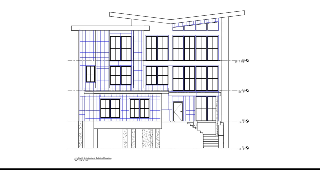
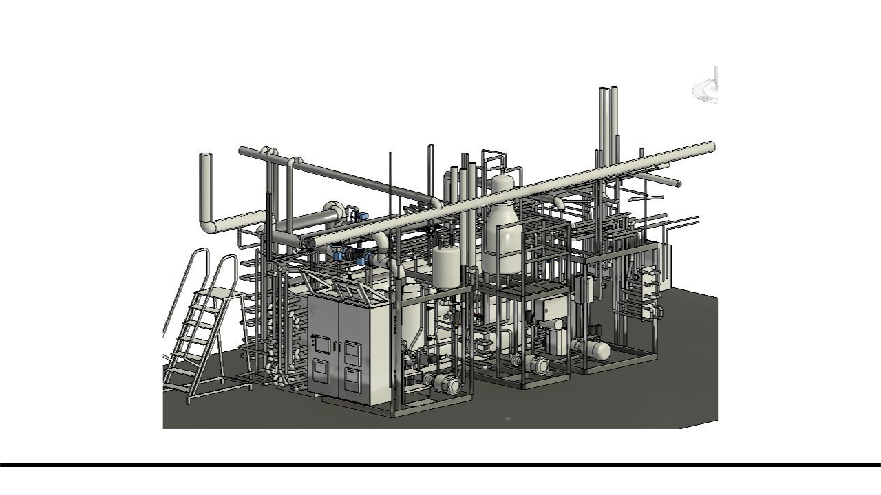
Real deliverables are the fastest way to understand the category. Open the as-built models we delivered, then walk a Matterport walkthrough for the visual side. Ten minutes inside those files teaches more than any brochure.
Choose your path
Match the deliverable to your downstream workflow, then let the deliverable dictate the capture method. Worked forward from the question you are actually answering:
- Your team designs in Revit and needs accurate existing conditions: commission scan-to-BIM. Read what scan-to-BIM is and how to spec it before writing the RFP.
- Your team drafts in AutoCAD and needs plans, not a model: commission 2D as-builts from a terrestrial point cloud.
- You need to see and share the space, not measure it: commission a Matterport tour. The Matterport vs LiDAR guide states exactly where that line sits.
- Your own modeling team wants the raw dataset: commission a registered point cloud, and read the plain-English point cloud guide first so you request the right file format.
- You are pricing the project before scoping it: start with the 2026 laser scanning cost guide, built from real quote history.
- The subject is mostly exterior, roof, or site: drone photogrammetry, usually paired with terrestrial capture for the interiors.
Accuracy standards you can put in a contract
Two published standards turn a scanning contract from a handshake into a spec. Both are free to reference. Most purchase orders cite neither.
USIBD Level of Accuracy (LOA) v3.1, released January 2025, grades how accurate the captured and modeled data must be and how that accuracy gets verified. It replaces brochure language with contract language: instead of "high-precision scanning," your agreement states a measurable accuracy grade the deliverable has to meet.
BIMForum Level of Development (LOD) defines how developed each model element is, on a scale from LOD 100 to LOD 500, refreshed in 2025. LOD 350 exists specifically because LOD 300 proved too ambiguous for scan-to-BIM coordination work. Speccing the wrong LOD is the most common purchasing failure in this category: an owner orders LOD 300 by default, then discovers the MEP detail they expected lives at LOD 350. The scan-to-BIM explainer walks the LOD ladder with owner-level definitions.
Write both into the contract. Accuracy by LOA. Model development by LOD. Acceptance stops being a matter of opinion.
What reality capture costs
Pricing runs a wide, honest ladder. The shape and complexity of the project set the number more than raw square footage does.
| Project shape | Typical 2026 range | Timeline |
|---|---|---|
| Residential or single Matterport tour | $350-$2,000 | About half a day |
| Small commercial (5,000-15,000 sq ft), point cloud only | $3,000-$8,000 | 1-2 days field plus processing |
| 50,000 sq ft office, scan-to-BIM at LOD 300 | $25,000-$80,000 | 2-6 weeks |
| Industrial plant, mechanical room, or hospital wing | $50,000-$250,000+ | 4-12 weeks |
| Multi-building campus or school district | $100,000-$1,000,000+ | Multi-month |
Scan-to-BIM per-square-foot rates span $0.10 to $8.00+. That 80x spread is real, not noise. A warehouse is four walls and a slab. An MEP-dense mechanical room is fifty scan setups plus forty hours of custom Revit families for valves and hangers. Both get quoted under the same label. The full 2026 cost guide breaks a quote into its line items, mobilization, capture hours, registration, modeling, and QA, and explains why two quotes for the same building differ 80x.
Who does this work: 7,000 firms and no national brand
Roughly 7,000 firms operate in the U.S. surveying and mapping category (NAICS 541370), and no nationally recognized brand exists among them. U.S. reality-capture services total an estimated $2.0-2.5 billion in 2026, growing at 12-15 percent annually. About 70 percent of firms that use reality capture have fewer than 100 employees, and 76 percent of practitioners report fragmented toolchains, per DroneDeploy's State of Reality Capture report.
For buyers, that fragmentation shows up two ways. First, as the 80x pricing variance documented above: the same nominal service, quoted wildly differently because no shared spec exists. Second, as a hiring problem: most of these firms are excellent at the work and invisible to the people who need them. There is no national franchise, no standard spec sheet, and no shared quality bar. Every hire is a cold evaluation of a vendor you have never heard of.
How to hire a reality capture provider
Vet four things before you hire any provider: equipment, matched to the accuracy your project needs from the hardware table above; training; deliverable quality, verified by requesting a sample .E57 or Revit model from a comparable project; and insurance. Then write USIBD LOA and BIMForum LOD into the contract so acceptance is measurable.
Or describe the project once and let us handle it. We hold ourselves to those same four standards on every job. Coverage is nationwide, and growing. You describe the building in plain words. We translate it into a spec, capture it, and check the deliverable against LOA and LOD standards before you accept it.
Questions buyers actually ask
Is reality capture the same as 3D scanning?
3D laser scanning is one method of reality capture. Reality capture also includes photogrammetry, drone mapping, mobile SLAM, and 360-degree capture like Matterport.
Which capture method do I need?
Match the method to the accuracy your downstream use requires: ±2-4 mm terrestrial scanning for design and construction, 1-3 cm mobile SLAM for fast large-area capture, Matterport for visual walkthroughs, drones for exteriors and sites.
What does reality capture cost?
From $350 for a residential Matterport tour to $1,000,000+ for a multi-building campus. A typical small commercial point cloud runs $3,000-$8,000, and a 50,000 sq ft scan-to-BIM model at LOD 300 runs $25,000-$80,000.
How accurate is reality capture?
Survey-grade terrestrial scanners hold ±2-4 mm at 10-20 m. Accuracy should be specified in your contract using the USIBD LOA v3.1 framework, not left to brochure language.
Who buys reality capture?
Architects and AEC firms commissioning as-builts for renovation, general contractors verifying and coordinating construction, facility managers planning capital work, real estate teams ordering tours and floor plans, industrial plants documenting piping and running clash detection, and school districts commissioning critical-incident maps.
About the author
The ScanningAndModeling team writes these guides from the field, the people who scan, model, and deliver reality-capture work across the country every week. Plain-English answers with real numbers, so you can spec a project without guessing.